Stage 5 Geography Sustainable Biomes
In this topic students investigate food production in Africa. Effects upon the citizens, the environment and what are the relationships African nations have with first world countries that loan them money (NESA Geography Syllabus K-19).
Pedagogical processes were texted based, however now real time examples via Non-Government Organisations web sites. Martins (2017) reflects upon Geography is a dynamic subject, its response to the current social and environmental changes.
Akinboade et al (2022) work benefits the of ICT (Information and communication technology) to food security as a method of improving rural populations liveability. There are barriers to the adoption of ICT in Africa (Ayim et al 2022) with illiteracy and poor network access major features of this. But Akinboade’ et al (2022) work shows the benefits in food security and welfare from the use of ICT. Linking into the syllabus outcomes.
The benefit to Australian geography students is from web-based access to NGO sites. Such as Food and Agriculture Organisation of the United Nations (https://www.fao.org/digital-services/country-cases/en) is they can provide the students with up-to-date data and developments.
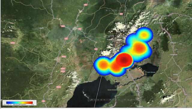
Students have the ability to create geographic, such as (https://www.cimmyt.org/) International Maize and Wheat Improvement Centre 50% of Maize and Wheat is grown in the developing world. The reporting of palm oil plantations https://essd.copernicus.org/articles/13/1211/2021/. Even the use of maps (figure 1) from the Grameen Foundation (https://www.google.com/intl/en_au/earth/outreach/success-stories/grameen-foundation-a pplab/) to show an infectious disease in the chicken population.
A teacher can provide an initial direction of sites for the students to investigate, compare, contrast, evaluate, discuss or describe the data. The ability to gain better geographic the use of Web-based technology (and maps) in the literature (Xiang and Liu 2017) assist students learning outcomes.
The key takeaway is the teachers changing use of the TPACK framework. Nguyen et al (2022) expresses the need for teachers to be active learners, controlling their own ‘technology-enhanced lessons’. Accessing using current data promotes the active learning.
Use of current data, ties back to Martins (2017) reflection of geography as a subject of constant change. Stage 5 geography students examining food security issues are receiving the current data by the increasing use of ICT integration in Africa (Akinboade et al 2022) enhances the student’s ability to present timely data written an investigation. Students are able to ‘undertake geographical inquiry to extend knowledge and understanding, and make generalisations and inferences about people, places and environments through the collection, analysis and evaluation of primary data and secondary information.’ (NESA geography syllabus K-10).
NGO Web sites for Students
AATF https://www.aatf-africa.org/
FAO https://www.fao.org/digital-services/country-cases/en
2023, Geography Bulletin 55(2), 8-11
Akinboade, O. A., Taft, T., Weber, J. F., Manoko, O. B., & Molobi, V. S. (2022). Correlates of access to ICT and food security of the poor in South Africa’s Soshanguve. GeoJournal, 87(6), 5165–5178. https://doi.org/10.1007/s10708-021-10550-y
Ayim, C., Kassahun, A., Addison, C., & Tekinerdogan, B. (2022). Adoption of ICT innovations in the agriculture sector in Africa: a review of the literature. Agriculture & Food Security, 11(1), 1–16. https://doi.org/10.1186/s40066-022-00364-7
Descals, A., Wich, S., Meijaard, E., Gaveau, D. L. A., Peedell, S., and Szantoi, Z., (2021), High-resolution global map of smallholder and industrial closed-canopy oil palm plantations, Earth System Science Data, 13(3), 1211–1231, https://doi.org/10.5194/essd-13-1211-2021
Martins, F., (2017), Chapter 14 Teaching to Develop Geographical Thinking. Brooks, C., Butt, G., & Fargher, M. (2017). In The Power of Geographical Thinking. Springer International Publishing AG. https://doi.org/10.1007/978-3-319-49986-4_14
Xiang, X., & Liu, Y. (2017). Understanding “change” through spatial thinking using Google Earth in secondary geography. Journal of Computer Assisted Learning, 33(1), 65–78. https://doi.org/10.1111/jcal.12166
Image source https://www.google.com/intl/en_au/earth/outreach/success-stories/grameen-foundation-applab/
