Geography
GIS (Geographic Information System)
There is great potential to unlock a student’s learning abilities if GIS was an integral part of the geography curriculum (Fargher 2017). It is the lack of product knowledge about GIS by teachers that is the greatest barrier to entry (Hodza et al 2021).
Fargehr (2017) work describes the potential of GIS in the classroom as a game changer. Geography would not have a behaviouralist approach but a psychoeducational approach. The student would have as much agency in the classroom as the teacher. The ability of GIS is not limited by a set question posed; it has the functionality within the GIS package.
GIS integrates data about everything—and, at the same time, it provides a platform for intuitively understanding this data as an integrated whole. This GIS nervous system is providing a framework for advancing scientific understanding and integrating and analysing all types of spatial (Harder and Brown 2017).
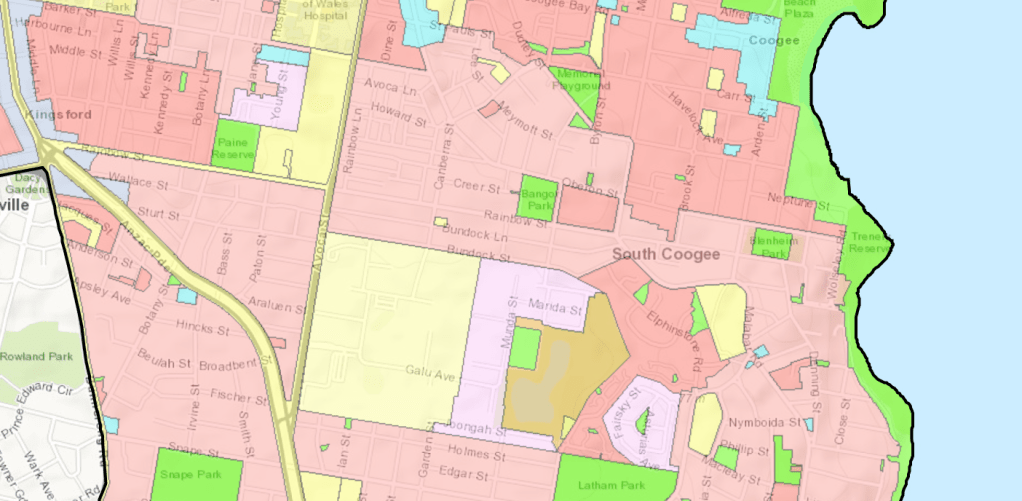
This land use map, of Randwick Council, shows the prescribe uses of land for planning purposes within NSW. (https://www.planningportal.nsw.gov.au/).
We can use the data to drive, create and make informed decisions (Harder and Brown 2017). The promise many such as Fargher (2017) and Hodza et al (2021) is to expand the abilities of students.
GIS data is not limited to a road or a street feature. It can include information of continuous data (harder and Brown 2017). These all sit over the ‘real world’ to allow a person to analysis this data spatially. Shown in figure 2 the pictural conception of the GIS.
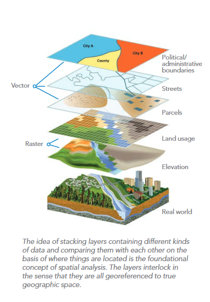
Figure 2.
Figure 3 shows a flow of data to a final analysis map. While figure 4 has a series of geographic tools which would be commonly used to assist in a problem-solving exercise.
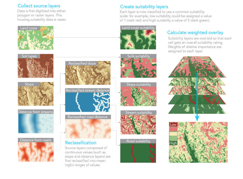
Figure 3.
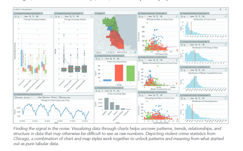
Figure 4.
Learning is enhanced by the ability of a student to create a ‘run program’ (geoprocessing tool). A set of instructions in the GIS which can be run repetitively with changes assumptions to discover alternatives. A simple geoprocessing tool is illustrated in figure 5. Blue is data, yellow is a command and green is a result. Repeating a process to understand alternatives is a simple matter of changing the parameters within any of the yellow boxes.
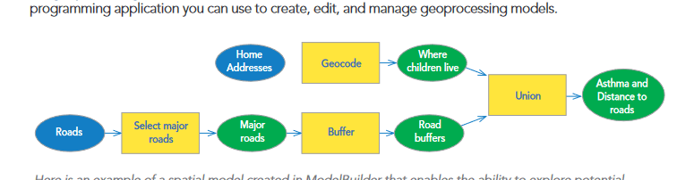
Figure 5
Our world is increasingly being challenged by expanding populations, loss of nature, environmental pollution, and the increasing dilemma of climate change and sustainability…. GIS technology and GIS professionals will play an increasingly important role in how we respond to and confront our collective problems (Jack Dangermond from Harder and Brown 2017). GIS within the geography curriculum creates the potential of students to develop their higher order critical thinking skills. It is the goal Fargher (2017) and Hodza et al (2022) wrote could be unlocked by this tool when using G.I.S in the classroom.
Fargher, M., (2017), Chapter 11 GIS and the power of Geographical Thinking. Brooks, C., Butt, G., & Fargher, M. (2017). In The Power of Geographical Thinking. Springer International Publishing AG. https://doi.org/10.1007/978-3-319-49986-4_14
Harder, C., and Brown, C., Editors (2017), The ArcGIS book: 10 big ideas about applying the science of where., 2nd edition. ESRI USA https://downloads.esri.com/esripress/PDFs/The-ArcGIS-Book-second-edition.pdf
Hodza, P., Berendsen, M. E., & Hamerlinck, J. D. (2021). Towards a holistic framework for delivering quality GIS education within and across disciplines. Transactions in GIS, 25(4), 2146–2167. https://doi.org/10.1111/tgis.12773
